About All Tours Boat ToursKauai Helicopter ToursSnorkel ToursCatamaran Cruise ToursZodiac Raft ToursCave ToursSunset Tours Directions Hours & Fees
Find Tours 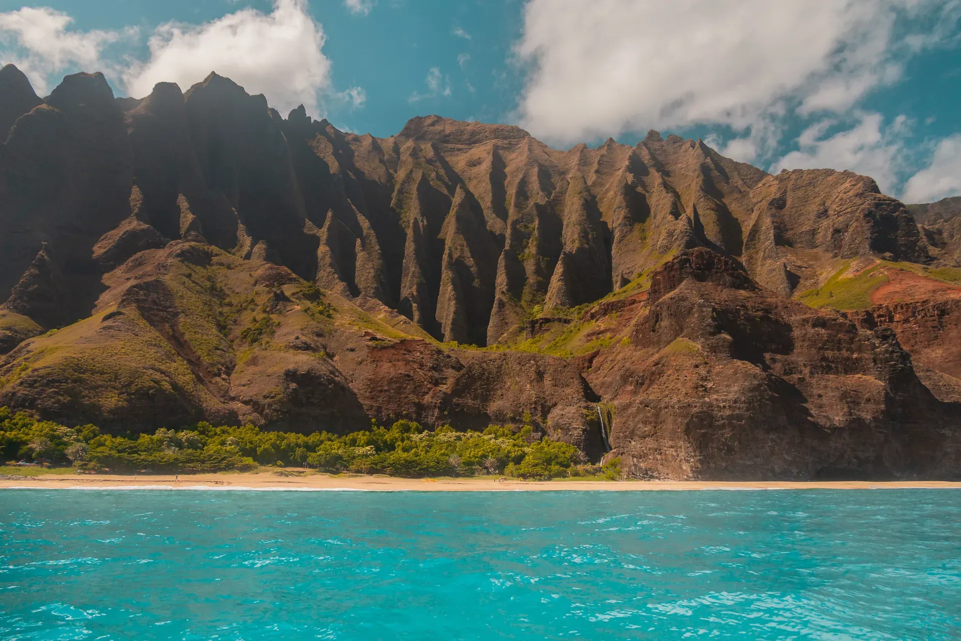
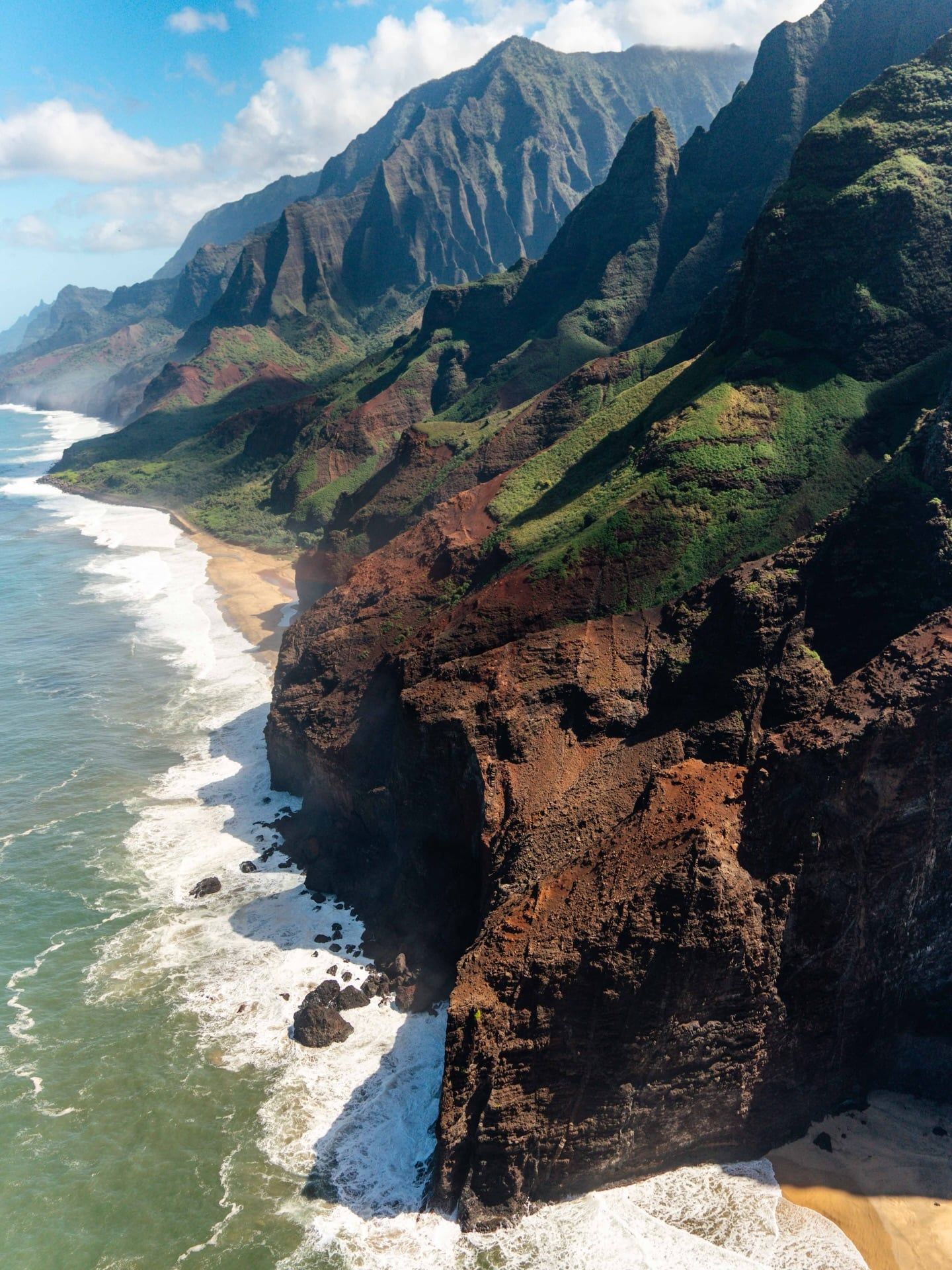
Na Pali Coast spans 17 miles of roadless wilderness along the northwest shore of Kauaʻi, Hawaii. Towering 4,000-foot emerald cliffs drop directly into the Pacific Ocean, accessible only by foot, boat, or helicopter.
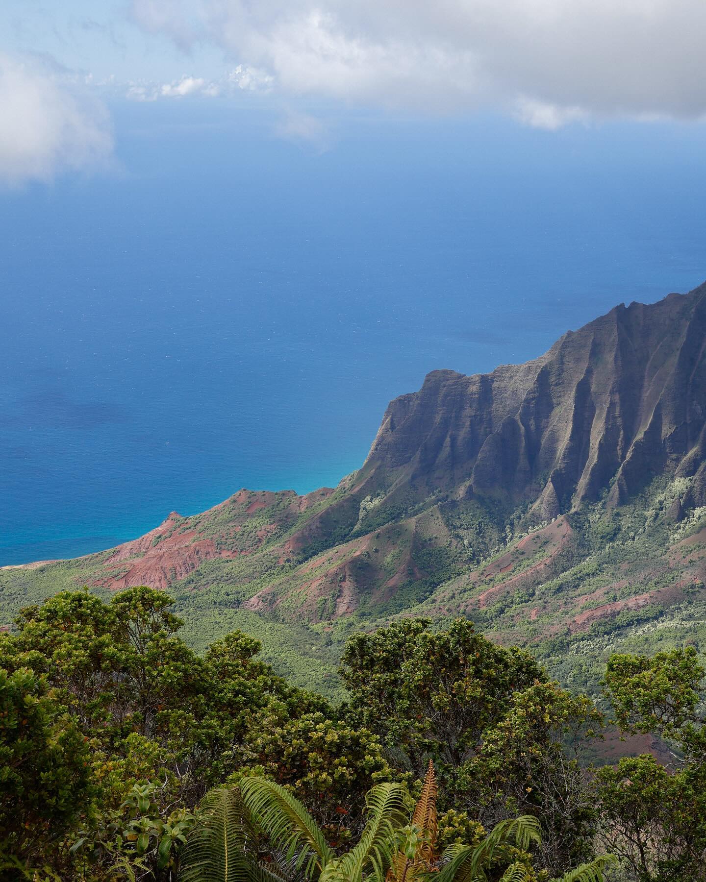
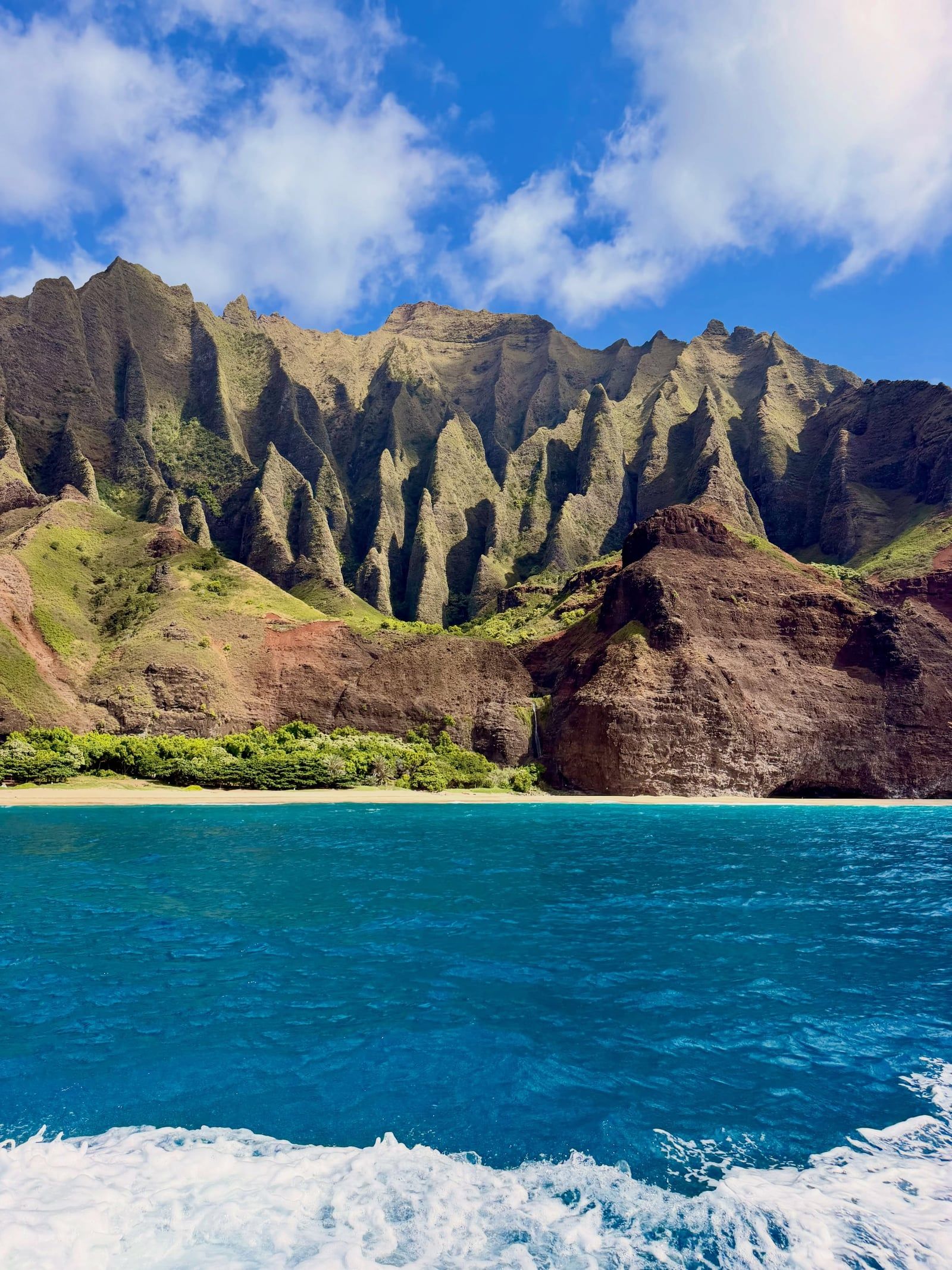
Seventeen miles of roadless, jagged coastline define the northwest edge of Kauaʻi. Basalt cliffs rise 4,000 feet from the Pacific Ocean, forming the Nāpali Coast State Wilderness Park. No vehicles can enter this terrain. Visitors reach the deep valleys, sea caves, and remote beaches by hiking the 11-mile Kalalau Trail, navigating the ocean by boat, or flying overhead in a helicopter. The landscape shifts rapidly from dry desert scrub at Polihale State Park to dense tropical rainforest near Keʻe Beach. Salt spray coats your skin on the boat ride from Port Allen, and the roar of twin outboard engines echoes off the rock walls as captains maneuver rafts into open-ceiling sea caves.
Ocean swells batter the shoreline during the winter months from November to March, making boat access impossible and triggering flash floods in the narrow valleys. Summer brings calmer waters, allowing catamarans to drop anchor near the reef. Snorkelers jump into 75-degree water to swim alongside green sea turtles and butterflyfish. Hikers on the Kalalau Trail face slick, muddy ridges and sheer drop-offs where a single misstep leads to a 300-foot fall into the ocean below.
Access requires strict adherence to state permit systems. Hawaii residents enter Hāʻena State Park for free, while non-residents pay a $5 entry fee and $10 for parking. Anyone hiking past the two-mile mark at Hanakāpīʻai Valley must carry a valid camping permit, which costs up to $35 per night. Reserve shuttle tickets and entry passes at gohaena.com exactly 30 days before your planned visit.
Volcanic eruptions formed the island of Kauaʻi five million years ago. Massive water flows from Mount Waialeale, which receives 448 inches of rain annually, carved deep valleys into the shield volcano's flanks. Polynesian navigators arrived on these shores around 1200 AD. Tahitian migrants followed, establishing self-sustaining communities in the isolated valleys of Kalalau and Nuʻalolo Kai. They built extensive stone-walled terraces to cultivate taro, manipulating the constant stream flow from the high mountains through complex irrigation channels.
The coast operated as a primary trade route connecting Hanalei, Waimea, and the neighboring island of Niʻihau. Outrigger canoes transported goods along the sheer cliffs, bypassing the impassable mountain ridges. Captain James Cook anchored off the Hawaiian coast in 1778, initiating Western contact. Foreign diseases decimated the native Hawaiian population over the next century, dropping the island's numbers drastically. Missionary Hiram Bingham documented the remaining inhabitants in 1821, noting the active agricultural systems still operating in the steep valleys.
Western influence fundamentally altered life on the coast. Missionaries banned traditional practices like hula in the 1820s, accelerating the cultural decline. Residents slowly abandoned the remote valleys for accessible towns with modern schools, cash economies, and medical care. The last native Hawaiians left the Kalalau Valley by the mid-20th century, leaving behind the stone foundations of their homes and farms.
The State of Hawaii established the Nāpali Coast State Wilderness Park to protect the archaeological sites and fragile ecosystems. Modern conservation efforts focus on managing human impact and combating invasive species. The Rapid ʻŌhiʻa Death fungus currently threatens the native forests, requiring hikers to decontaminate their boots with 70% rubbing alcohol before stepping onto the trail.
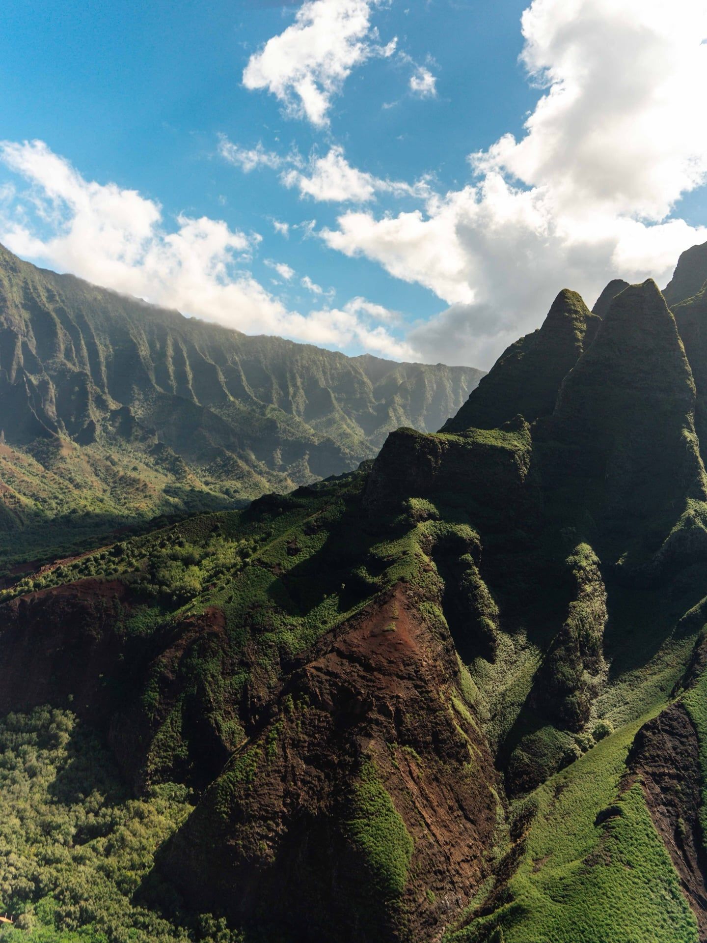
Four thousand feet of fluted basalt rock dominate the shoreline. Five million years of wind, rain, and ocean waves have eroded the original shield volcano into a series of razor-sharp ridges and deep, V-shaped valleys. Mount Waialeale acts as a massive rain catch, funneling up to 450 inches of annual precipitation down the mountain slopes. This constant water flow creates temporary and permanent waterfalls that cut through the green cliffs and drop directly into the saltwater below.
The coastline spans three distinct climate zones over its 17-mile stretch. The western edge near Polihale State Park features arid, desert-like conditions with sparse vegetation and red dirt. Moving east toward Keʻe Beach, the environment transitions into a temperate rainforest and finally a dense tropical canopy. Sea caves dot the waterline, hollowed out by the relentless pounding of winter ocean swells. Some caves feature open ceilings where sections of the cliff face collapsed decades ago, allowing sunlight to illuminate the dark water.
Geological destruction continues today. Tectonic activity is slowly sinking the island of Kauaʻi, while 70% of its beaches experience active erosion. Heavy rainfall frequently causes flash floods in the Hanakāpīʻai Stream, turning clear water into a dangerous, muddy torrent carrying tree branches and boulders. Hikers must monitor the stream conditions and turn back immediately if the water level rises abruptly.
Native Hawaiians view the Na Pali Coast as a sacred landscape. The valleys of Kalalau and Nuʻalolo Kai contain hundreds of ancient archaeological sites, including heiau (temples), house foundations, and extensive loʻi kalo (taro terraces). These stone structures demonstrate the advanced agricultural engineering of early Hawaiian settlers who manipulated stream flows to feed thousands of people in an isolated environment. The physical remnants of these villages remain visible to hikers navigating the valley floors.
The sheer cliffs functioned as a natural fortress, protecting the valley inhabitants from rival chiefdoms. Travel between valleys required deep knowledge of the ocean currents and seasonal swells. Removing rocks or sand from these beaches violates state law and carries deep cultural taboos. Local traditions dictate that taking natural elements from the coast brings severe bad luck to the offender.
Endangered species rely on this protected habitat. The Hawaiian goose (nēnē) and the vulnerable Hawaiian petrel nest along the remote ridges. Federal laws prohibit visitors from approaching or harassing the green sea turtles and monk seals that rest on the secluded beaches. Keep a distance of at least 50 feet from all marine mammals, and never block their path to the water.
Mount Waialeale receives 448 inches of rain per year, ranking among the wettest spots on Earth.
Commercial drones are illegal to launch from the state park, but flying them is permitted if launched outside park boundaries.
Unlicensed boat operators frequently offer illegal drop-offs at Kalalau Beach, risking heavy fines and stranding passengers.
The Kalalau Trail gains 800 feet in elevation but constantly undulates, resulting in thousands of feet of actual climbing.
Green sea turtles and endangered Hawaiian monk seals frequently haul out on the remote beaches to rest.
The Rapid ʻŌhiʻa Death fungus threatens the native trees, prompting strict boot-cleaning protocols for all hikers.
Campers cannot spend more than two consecutive nights at the Hanakoa campsite along the trail.
Yes. Anyone hiking past Hanakāpīʻai Valley requires a valid camping permit. Permits cost $25 per night for Hawaii residents and $35 for non-residents.
The trail measures 11 miles one way, making it a 22-mile round trip. Hikers navigate wet gulches, narrow ridges, and an 800-foot elevation gain.
The Nāpali Coast State Wilderness Park opens daily from 7:00 am to 7:45 pm. Hāʻena State Park closes at 6:45 pm during the winter months.
No treated drinking water exists on the trail. Hikers must pull water from streams and treat it with filters, purification tablets, or boiling to prevent leptospirosis.
No. Commercial boat operators cannot legally drop off or pick up passengers at Kalalau or Miloliʻi camping areas.
Prices start around $150 per person for basic raft tours. Premium catamaran tours with meals and snorkeling can cost up to $400 per person.
The state restricts camping permits to a maximum of five nights within the wilderness park.
Launching or landing drones within the state park is illegal. Pilots must launch from outside park boundaries and follow all FAA regulations to fly over the water.
Non-residents pay a $5 entry fee and $10 for parking, which requires an advance reservation. Hawaii residents enter for free with a valid state ID.
The dry summer season runs from April to October with temperatures in the low 80s. Winter brings heavy rainfall, flash floods, and massive ocean swells from November to March.
Browse verified tours with free cancellation and instant confirmation.
Find Tours